
Advantages
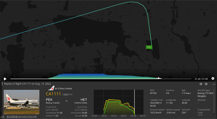
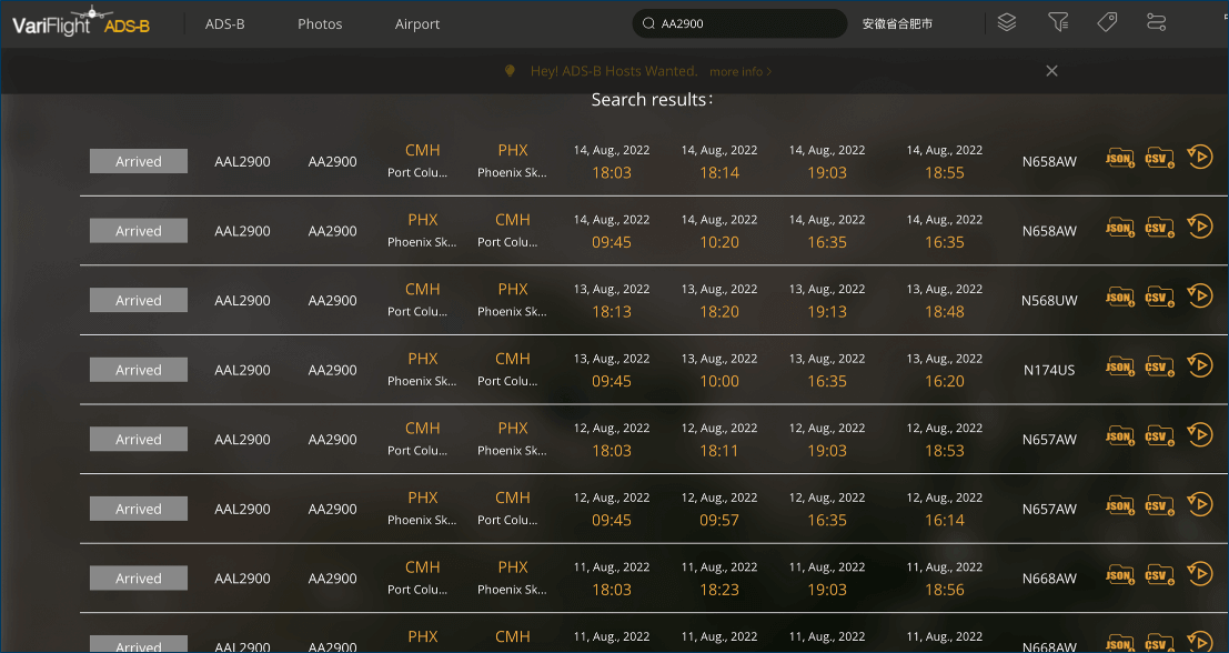
Automatic Dependent Surveillance–Broadcast (ADS–B) is an advanced surveillance technology that combines an aircraft's positioning source, aircraft avionics, and a ground infrastructure to create an accurate surveillance.
VariFlight's global terrestrial and space-based ADS-B systems advantages:
Polar region, ocean, desert area aircrafts navigation, surveillance service.
Airports, runways surface real-time monitoring.
Constitute the multi-satellites system, and offer MLAT functional space-based ADS-B data.

Promote aviation operation safety by adding ground plus air surveillance.

Air travelers can learn the position and status of a flight more directly.

Enhance airspace and airway situational awareness capability.

Optimize service standards for related services like airport pick-up.

Generate customized aircraft operation and airway situation reports.

Help businesses from more industries to adapt to ever-changing market needs.
Civil aviation
Empower civil aviation administrations, ATCs, airlines, ANSP (Air navigation service provider) with more accurate and multi-dimensional aviation data: more precise ETD/ETA; automatically runway information acquisition; automatically flying trajectory acquisition; more scientific traffic management in decision-makings; timely aircraft abnormal operation alerts.
National defense
Arm military with round-the-clock airspace monitoring and accurate hostile recognition. Intensify air force joint battle capability of cyber information system and strategy situational awareness.


Aircraft leasing
Overall, accurate, and real-time aircraft life-cycle management data solutions, elevate lessors’ capabilities in aircraft health and asset management.
Search and rescue
The highly precise GPS-based surveillance provided by ADS-B also improves the ability to perform life-saving search and rescue missions. Air traffic controllers tracking aircraft with ADS-B Out have more accurate information about last reported positions, helping to take the "search" out of search and rescue.
Build a monitoring system base
on the customer's scenario
Monitor specified fleets ( airlines, lessors, etc) real-time flying path and position.
Monitor a specific area, a circle area, a big city, radius=500km, trigger warnings if an
abnormal plane enters this area.
Bespoke data reports
How many airplanes flew near my city last month
What are the historical trajectories of the certain airline flights, etc.

API query and push
Global ADS-B data
Certain area ADS-B data
Certain fleet ADS-B data